Gone are the days where people are afraid to go to new places because of the fear of getting lost. Today, various useful navigation apps are available to provide directions and routes to drivers and travelers. One of them is Google Maps.
Google Maps has been around for quite some time, however, most people don’t know the full extent of the services provided by the app. Philkotse.com will help you understand the basics of Google Maps and the things it can do for you.
1. Everything you need to know about Google Maps
Google Maps is developed by Google that offers a web mapping service. It provides street maps, aerial photography, satellite imagery, real-time traffic conditions, 360 degrees panoramic views of streets, and route planning for traveling by bicycle, car, public transportation, air or even on foot.
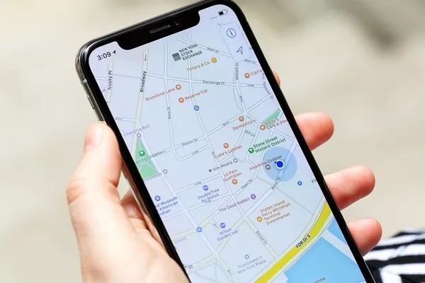
Google Maps was launched and first announced on the Google Blog held on February 8, 2005
Today, Google Maps is one of the leading navigation apps used by travelers, road users, and drivers to help them with their daily drives, travel, and tours. Aside from navigation, there are other things that Google Maps can provide. Read on to find out.
>>> Check out: Driving in the Philippines: Google Maps have an update for the coding day.
2. What Google Maps can do for you
Here are the functions and services provided by Google Map
Transportation directions
Google Maps provide users with directions on which transportation method is available in a particular place, including the details that come with the different methods. It gives users information about the places where they can catch the bus and any related data. It also enables users to search for available routes and directions through walking, biking, and public transportation.
Google has global partners, with more than 800 public transit are adopting the General Transit Feed Specification or the GTFS. It will make the information available to 3rd parties.
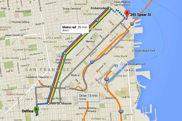
Google Maps provide users with directions on which transportation method is available in a particular place
Creates maps
If the user's location is particularly obscure, then he/she might have problems searching for a coherent diagram providing accurate routes or directions. In this case, Google Maps will allow the user to create his/her map.
Show distance and the estimated time of arrival
When utilizing the Google Maps feature, it will allow you to determine the distance of your current location to any particular point on the map. All you need to do is click the specific point, and then the app will tell you its distance from your location as well as the estimated traveling time to get there. This function enables users to plan their travels and organize their schedules.
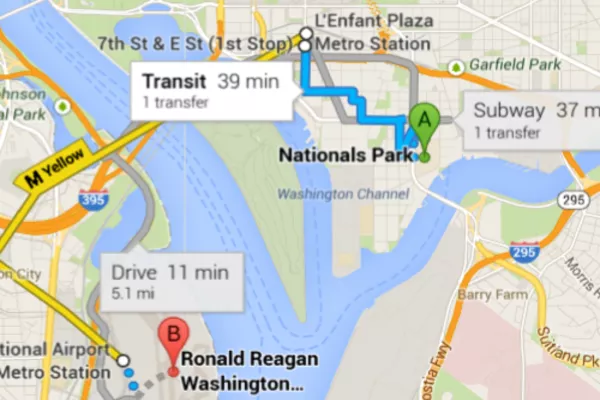
Google Maps allow you to determine the distance of your current location to any particular point on the map
>>> You might like to read: 5 must-know tips to make better use of navigation car apps.
Mix map Infos
To do this, you will need a few technical know-how. Google Maps enables the user to add additional details and information to the map if he/she knows how. Information such as special occasions, celebrity sightings, etc. can be added to the map.
Looking for your location
If you’re on a trip to a place new to you, or somewhere unfamiliar, you can use Google Maps to determine your exact location. It is a great feature that can save you from getting lost.
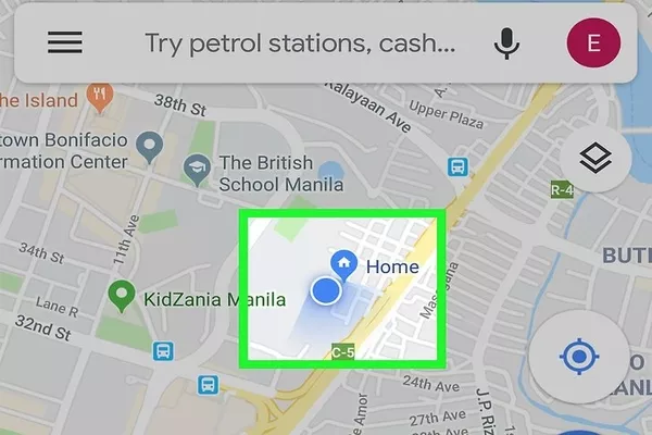
You can use Google Maps to determine your exact location
Set routes
You can set the Google Map to your preferred way if you already have specific routes in mind. After setting the routes, all you need to do is to follow the directions. This feature enables users to customize their ways which will better provide convenience for them.
This feature is called " My Maps" which was launched in April 2007. It is a very handy feature, especially if you're the type of driver or traveler who creates custom maps for sharing or personal use. Users can add images, notes, lines and points on top of the Google Map with the use of WYSIWYG editor.
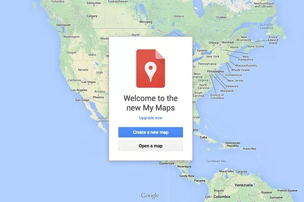
You can set the Google Map to your preferred way if you already have specific routes in mind
Traffic information
Every driver knows how frustrating it is to be stuck in traffic jams. Good thing Google Maps can help you search for better routes. The app will suggest the best path for you and will let you know if a specific place in your course is congested in that particular time of the day.
They use crowdsourcing to collect the GPS-determined areas of large numbers of cellphone users. That is how they produce live traffic maps.
>>> Have you known 5 other smart things you can do with your GPS?
Verbal instructions
Some drivers and users are unaware that they can simply instruct Google Maps about the place they want to go. No need to type it. It is a great feature, especially when driving. It will let drivers focus more on the road instead of using their hands to input their destination.
Share location
Google Maps also enables users to share their place with their family or friends. Location sharing can either be for informing your colleagues, friends, and family of your location. It can also be used to tell your friends that you're in that particular area in case you need to hook up with them.
Google Maps also enables users to share their place with their family or friends
Edit locations
Google Maps is not a perfect app. There are instances where certain information or details about a location is incorrect. The app allows users to edit and correct that information if they like.
Street View
With Google Maps, users will be able to see 360 degrees panoramic street-level views of different locations.
Business listings
Google Maps also provide users with different business listings from off-line and on-line sources. You can use Google Maps to look for the nearest hotels, restaurants, fast-food chains, coffee shops, gasoline stations, banks, hospitals, etc.
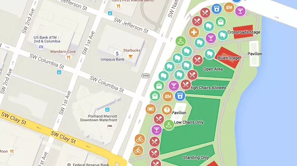
You can use Google Maps to look for the nearest hotels, restaurants, fast-food chains...
>>> Recommended for you: Smart driving: Want a perfect drive? Consider these 5 car apps.
Indoor maps
Aside from business listings, Google Maps also enables users to navigate themselves inside buildings like transit stations, universities, big-box stores, shopping malls, museums, airports, and many other public areas including facilities built underground.
Users can see the different building floors or subway stations by simply clicking on the level selector displayed near buildings or structures that are mapped on multiple floors or levels.
Google Maps is indeed an amazing navigation app that offers lots of other features aside from giving directions. That explains why Google Maps is topping the list when it comes to the most trusted and most utilized navigation app in the world.
Recent posts
- What have you known about vehicle tracking system? Aug 16, 2022
- What you need to know about tipping carwash and other services Nov 30, 2022
- 5 must-know tips to make better use of navigation car apps Nov 30, 2022
- 4 Recommended Mobile Apps for Filipino Drivers to Track Car Maintenance Aug 09, 2022
- Apps (other than Waze) to help you survive driving in the Philippines Aug 25, 2021


